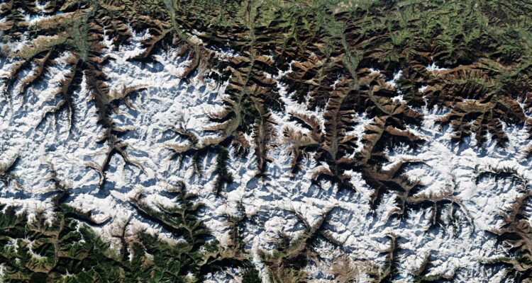
Can We Use Satellite Buses for Geological Monitoring?

Earth Observation satellites (EOS) help with monitoring a lot of processes, i.e., forestation, pollution levels, wildlife, effects of climate change, etc. As a rule, satellite buses, platforms that carry most of a satellite’s equipment and electronics, also carry advanced cameras and remote sensors to take detailed images of the Earth and compare how these images change over time.
Today, EO satellite buses are also widely used for geological monitoring — a specific segment of observation that focuses on various aspects of our planet’s geology, such as the availability of mineral resources, the geological history of a region, main processes occurring in a given region, natural or industrial hazards of exploring mineral resources in a given area, etc. So, how exactly do satellite buses help with geological environment monitoring? Let’s start from the very beginning.
What is the function of a satellite bus?
This is one of the main structural elements of any spacecraft, carrying all electronic equipment and tools. The main function of a satellite bus is to ensure a spacecraft stays operational and accomplishes its tasks. Besides systems that ensure navigation, power supply, temperature, and communication with the ground, satellite buses for geological monitoring also carry imagers or remote sensors — depending on the exact mission type. Manufacturers usually do not offer satellite buses for geological monitoring for sale — not exclusively, at least. Today, most buses have modular designs that can be accommodated to any needs. So, the exact choice of equipment and payloads will depend on the geological monitoring methods used in each mission.
What is the geological investigation?
Geological investigation is a systematic study and monitoring of the Earth’s surface, its materials, and history. The received data can be used in different fields, including engineering, mining, construction, environmental protection, geological disaster monitoring, etc. This is a vast, interdisciplinary area that uses a variety of methods, such as mapping (both from space using satellite and on-site using any necessary field equipment), monitoring, sampling, mineral analysis, hydrological analysis, etc. The investigation that happens from space also primarily depends on monitoring and mapping — in particular, through satellite imagery and aerial photography.
What is geological mapping?
Similar to geological monitoring and investigation, mapping relies on the constant study of fields, rocks, minerals, etc. So, what do geological maps show? That depends on a particular map type — anything from minerals, fossils, and other geological formations to more habitual topography is possible. Satellite imagery has contributed greatly to mapping in general and geological mapping in particular.
One of the primary benefits of taking satellite pictures for monitoring and mapping is that researchers can see exactly how each area changes over time. This way, it becomes easier to analyze any seasonal changes or see the impact of industrial activity. Also, depending on what does geological map identify, it is possible to predict future geological development and provide 24/7 monitoring of industrial and natural hazards.
Top Areas of Geological Monitoring from Space
Besides mapping for research or mineral mining purposes, there are several hazardous areas remote sensing satellites are monitoring 24/7, namely:
● Landslides: landslides can happen naturally or as the result of human industrial activity. Whatever the case, EOS and remote sensing spacecraft can observe information on soil or rock displacement, record it, and transmit it back to Earth for analysis.
● Volcanic activity: volcano eruptions never happen without a warning, so monitoring for changes in volcano activity ensures timely response to natural disasters. Satellites with infrared sensors can capture any temperature changes in the volcanic regions, timely alerting the scientists.
● Tectonic activity: Interferometric Synthetic Aperture Radar (InSAR) satellites can analyze ground deformation caused by tectonic activity. With the right analysis tools, this monitoring data can warn about an upcoming earthquake, for example.
● Environmental changes: EOS is monitoring our planet for any natural and industrial changes in land cover, i.e., deforestation or urbanization. As already mentioned, geological investigation is a vast interdisciplinary process, and data on changing land covers is also used for climate change monitoring.
● Vegetation health: this is also possible with remote sensing. In turn, information about vegetation health in given areas can offer insight into soil conditions or changes in its composition.
● Gas, oil, mineral resource extraction: the analysis of geological features can indicate areas rich in natural resources or warn about their scarcity.
● Various geological hazards: rockfall, coastal erosion, subsidence, avalanches, sinkholes, even tornadoes — all of these can be foreseen and prepared for if not prevented. On the whole, timely notification about natural hazards is a top priority for geological monitoring satellites.
All in all, EOS and remote sensing satellites in geological monitoring have many uses — the above list barely scratches the surface of what data can be obtained and how it can be later analyzed. With the miniaturization of spacecraft and satellite buses, mapping from space gradually becomes more affordable, so we are likely to see new developments in this field soon.
Got stuck in a game? Don’t worry, Steve is here to solve all your queries and give you some hacks about your favorite game.


